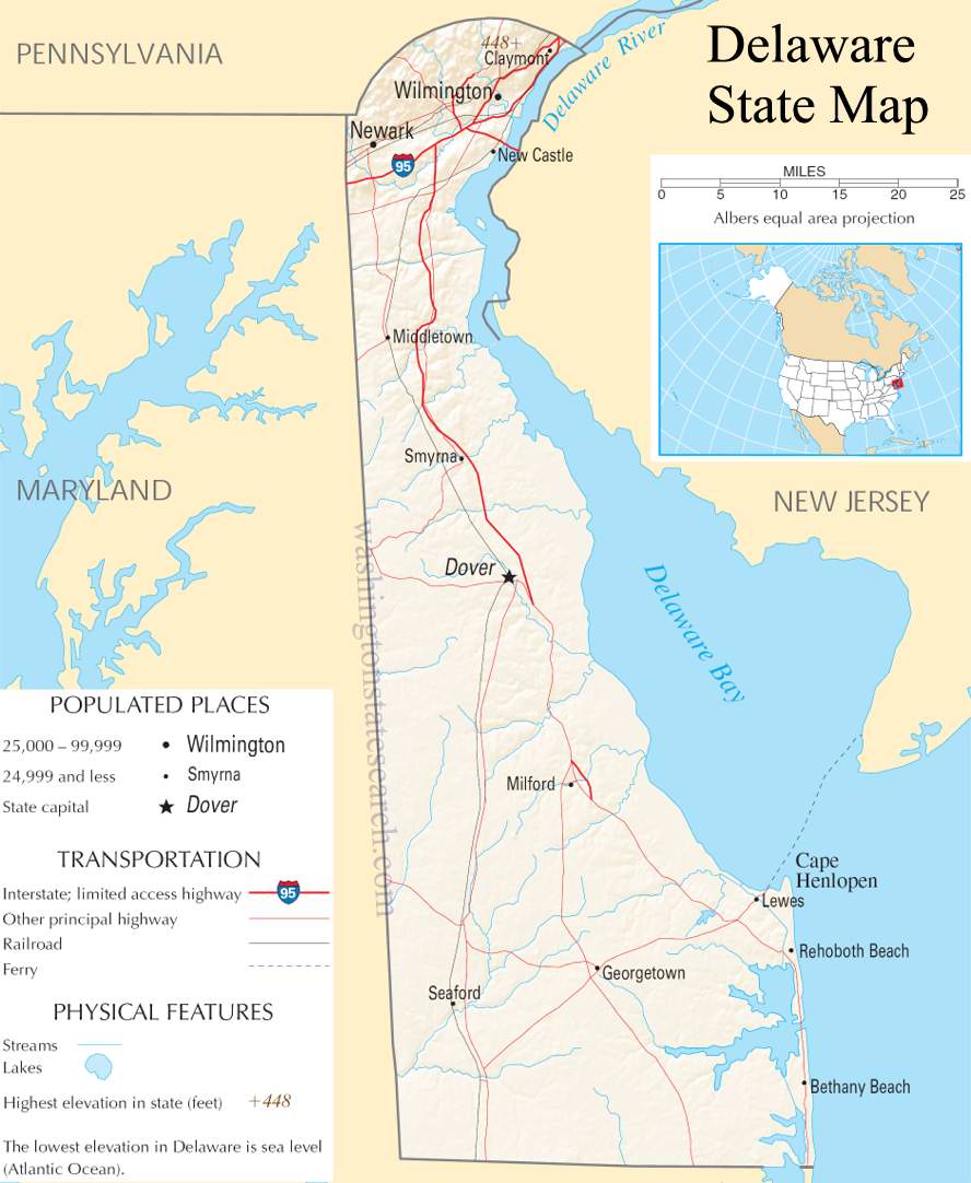
Delaware State Map
Home Page > United States Map > Delaware State Map
About Delaware State
Delaware is a state located in the Mid-Atlantic region of the United States. Here are some key points about Delaware:
Capital and Largest City
The capital of Delaware is Dover, and its largest city is Wilmington.
Nickname
Delaware is often referred to as "The First State" because it was the first of the 13 original colonies to ratify the United States Constitution on December 7, 1787.
Location
Delaware is on the Atlantic Coast and is bordered by Maryland to the south and west, Pennsylvania to the north, and New Jersey to the northeast. It also has a relatively short coastline along the Delaware Bay and the Atlantic Ocean.
Size and Population
Despite being the second smallest state in land area (after Rhode Island), Delaware has a relatively dense population. Delaware had a population of around 1.03 million people in 2023.
Economy
Delaware has a diverse economy with a strong emphasis on finance, banking, and corporate services. Many major corporations, including many Fortune 500 companies, have chosen to incorporate in Delaware due to its business-friendly laws and tax policies. Wilmington, the largest city, is known as a financial center.
Government
Delaware has a state government with a governor as the head of the executive branch. The General Assembly, consisting of the Senate and the House of Representatives, makes up the legislative branch.
Education
Delaware is home to several institutions of higher education, including the University of Delaware, Delaware State University, and Wilmington University.
History
Delaware has a rich history, dating back to the early colonial period. It played a significant role in the formation of the United States and was one of the original thirteen colonies.
Delaware Bay and River
The Delaware Bay, along with the Delaware River, is an important natural feature of the state. The bay supports a diverse ecosystem and is a vital area for migratory birds.
Tax-Free Shopping
One notable aspect of Delaware is that it does not have a state sales tax, making it a popular destination for shopping.
A large detailed map of Delaware State
This is a large detailed map of Delaware State.
View our Delaware State county map

from the National Atlas of the United States
United States Department of the Interior
Delaware State Map
The electronic map of Delaware State that is located below is provided by Google Maps. You can "grab" the Delaware State map and move it around to re-centre the map. You can change between standard map view and satellite map view by clicking the small square on the bottom left hand corner of the map. Satellite map view utilizes orbiting satellite or aerial high resolution photography to display images of the map location to street level detail (really quite amazing). Standard map view shows a traditional street map (also known as a road map). You can use the zoom buttons on the bottom right hand side of the map to zoom in or out to street level detail. We have maps for most towns and cities in the US, so click on the United States Maps link to see more American online maps.
Music


