Maps of Tyne and Wear England
Home > Maps of England > Tyne and Wear Maps
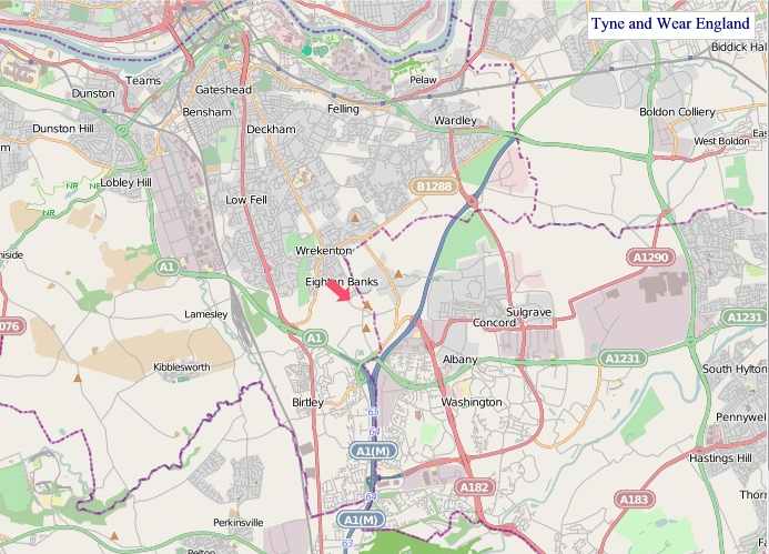
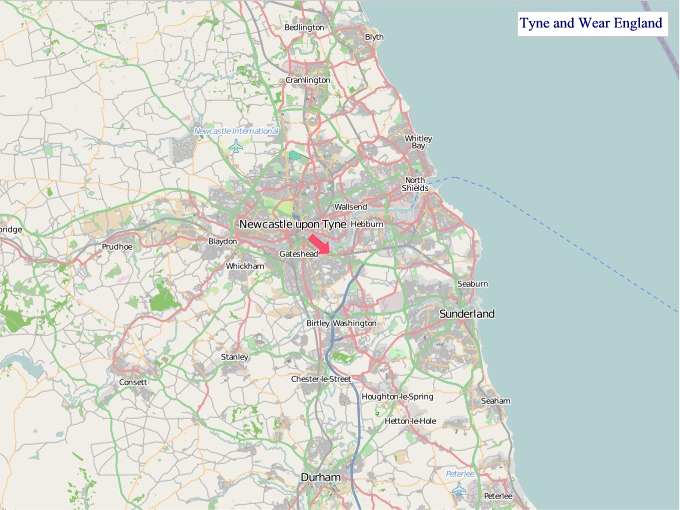
Welcome to our Tyne and Wear map page. The map of Tyne and Wear England that is located below is provided by Google Maps. You can "grab" the electronic map and move it around to re-center the map. You can change between standard map view and satellite map view by clicking the small square on the bottom left-hand corner of the map. Satellite map view utilises orbiting satellite and / or aerial high-resolution photography to display images of the map location to street level detail (really quite amazing). Standard map view shows a traditional street map (also known as a road map). You can use the zoom buttons on the bottom right-hand side of the map to zoom in or out to street level detail. We have digital online maps for most towns and cities on the Maps of England page. We also have a good collection of old school printable maps on the Maps of England page.
A map of Tyne and Wear, England
Tyne and Wear Maps
I hope you like the Tyne and Wear County, England street map / road map situated above.
If you like our website, please consider adding a link to the site. These links help to build website traffic and they are considered a vote of confidence for a site.
Tyne and Wear
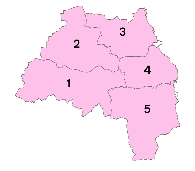
Tyne and Wear is a metropolitan county in North East England, situated around the mouths of the rivers Tyne and Wear. It came into existence in 1974 after the passage of the Local Government Act 1972. It consists of the five metropolitan boroughs of Newcastle upon Tyne, Gateshead, North Tyneside, South Tyneside and the City of Sunderland. The county is bordered to the north by Northumberland, to the south by County Durham and to the east of the county lies the North Sea. It is the smallest county in North East England by area, but by far the largest in terms of population.
Prior to the 1974 reforms, the territory now covered by the county of Tyne and Wear straddled the border between the counties of Northumberland and Durham, the border being marked by the river Tyne; that territory also included five county boroughs.
Tyne and Wear County Council, based at Sandyford House, was abolished in 1986 along with the other metropolitan county councils in England by the Local Government Act 1985, and so its districts (the metropolitan boroughs) have since functioned effectively as unitary authorities. However, the metropolitan county continues to exist in law and as a geographic frame of reference, and as a ceremonial county.
History
In the late 600s and into the 700s the Venerable Bede (Saint Bede) lived as a monk at the monastery of St. Peter and of St. Paul writing histories of the early of the Early Middle Ages including the Ecclesiastical History of the English People.
Roughly 150 years ago, in the village of Marsden in South Shields, Souter Lighthouse was built, the first electric structure of this type.
The Local Government Act 1888 constituted Newcastle upon Tyne, Gateshead and Sunderland as county boroughs (Newcastle had "county corporate" status as the "County and Town of Newcastle upon Tyne" since 1400). Tynemouth joined them in 1904. Between the county boroughs, various other settlements also formed part of the administrative counties of Durham and of Northumberland.
The need to reform local government on Tyneside was recognised by the government as early as 1935, when a Royal Commission to Investigate the Conditions of Local Government on Tyneside was appointed. The three commissioners were to:
examine the system of local government in the areas of local government north and south of the river Tyne from the sea to the boundary of the Rural District of Castle Ward and Hexham in the County of Northumberland and to the Western boundary of the County of Durham, to consider what changes, if any, should be made in the existing arrangements with a view to securing greater economy and efficiency, and to make recommendations.
The report of the Royal Commission, published in 1937, recommended the establishment of a Regional Council for Northumberland and Tyneside (to be called the "Northumberland Regional Council") to administer services that needed to be exercised over a wide area, with a second tier of smaller units for other local-government purposes. The second-tier units would form by amalgamating the various existing boroughs and districts. The county boroughs in the area would lose their status. Within this area, a single municipality would be formed covering the four county boroughs of Newcastle, Gateshead, Tynemouth, South Shields and other urban districts and boroughs.
A minority report proposed amalgamation of Newcastle, Gateshead, Wallsend, Jarrow, Felling, Gosforth, Hebburn and Newburn into a single "county borough of Newcastle-on-Tyneside". The 1937 proposals never came into operation: local authorities could not agree on a scheme and the legislation of the time did not allow central government to compel one.
Tyneside (excluding Sunderland) was a Special Review Area under the Local Government Act 1958. The Local Government Commission for England came back with a recommendation to create a new county of Tyneside based on the review area, divided into four separate boroughs. This was not implemented. The Redcliffe-Maud Report proposed a Tyneside unitary authority, again excluding Sunderland, which would have set up a separate East Durham unitary authority.
The White Paper that led to the Local Government Act 1972 proposed as "area 2" a metropolitan county including Newcastle and Sunderland, extending as far south down the coast as Seaham and Easington, and bordering "area 4" (which would become Tees Valley). The Bill as presented in November 1971 pruned back the southern edge of the area, and gave it the name "Tyneside". The name "Tyneside" proved controversial on Wearside, and a government amendment changed the name to "Tyne and Wear" at the request of Sunderland County Borough Council.
From Wikipedia, the free encyclopedia


"© OpenStreetMap contributors, CC BY-SA".
Districts of Tyne and Wear

1 - Gateshead
2 - Newcastle upon Tyne
3 - North Tyneside
4 - South Tyneside
5 - Sunderland
Music


