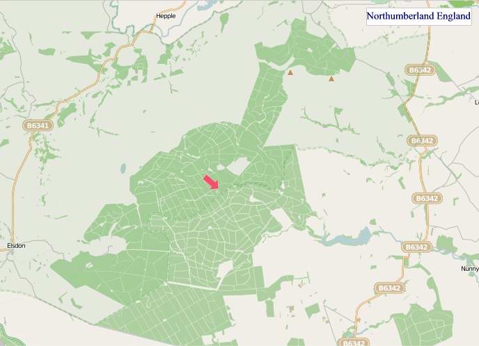
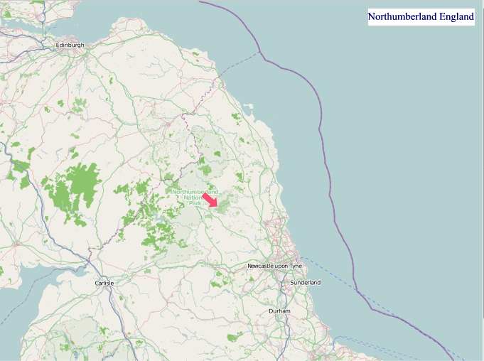
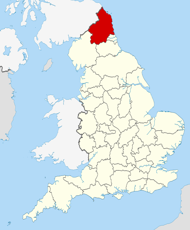
Maps of Northumberland England
Home > Maps of England > Northumberland Maps
Welcome to our Northumberland map page. The map of Northumberland England that is located below is provided by Google Maps. You can "grab" the electronic map and move it around to re-center the map. You can change between standard map view and satellite map view by clicking the small square on the bottom left-hand corner of the map. Satellite map view utilises orbiting satellite and / or aerial high-resolution photography to display images of the map location to street level detail (really quite amazing). Standard map view shows a traditional street map (also known as a road map). You can use the zoom buttons on the bottom right-hand side of the map to zoom in or out to street level detail. We have digital online maps for most towns and cities on the Maps of England page. We also have a good collection of old school printable maps on the Maps of England page.
A map of Northumberland, England
Northumberland Maps
I hope you like the Northumberland County, England street map / road map situated above.
If you like our website, please consider adding a link to the site. These links help to build website traffic and they are considered a vote of confidence for a site.
Northumberland
Northumberland is a ceremonial county and historic county in North East England. It is bordered by Cumbria to the west, County Durham and Tyne and Wear to the south and the Scottish Borders to the north. To the east is the North Sea coastline with a path 103 kilometres (64 mi) long. The county town is Alnwick. The county is administered as a unitary authority by Northumberland County Council, headquartered in Morpeth.
The county of Northumberland included Newcastle upon Tyne until 1400, when the city became a county of itself. Northumberland expanded greatly in the Tudor period, annexing Berwick-upon-Tweed in 1482, Tynedale in 1495, Tynemouth in 1536, Redesdale around 1542 and Hexhamshire in 1572. Islandshire, Bedlingtonshire and Norhamshire were incorporated into Northumberland in 1844. Tynemouth and other settlements in North Tyneside were transferred to Tyne and Wear in 1974 under the Local Government Act 1972.
Lying on the Anglo-Scottish border, Northumberland has been the site of a number of historic battles. The county is noted for its undeveloped landscape of high moorland, now largely protected as the Northumberland National Park. Northumberland is the least densely populated county in England, with only 62 people per square kilometre.
Name
The name of Northumberland is recorded as norð hẏmbra land in the Anglo-Saxon Chronicle, meaning "the land north of the Humber". The name of the kingdom of Northumbria derives from the Old English Norþan-hymbre meaning "the people or province north of the Humber", as opposed to the people south of the Humber Estuary.
History
The land has long been a frontier zone, with it being currently border for England and Scotland. Northumberland has a rich prehistory with many instances of rock art, hillforts such as Yeavering Bell, and stone circles such as the Goatstones and Duddo Five Stones. Most of the area was occupied by the Brythonic-Celtic Votadini people, with another large tribe, the Brigantes, to the south.
During Roman occupation of Britain, most of the present county lay north of Hadrian's Wall. It was controlled by Rome only for the brief period of its extension of power north to the Antonine Wall. The Roman road Dere Street crosses the county from Corbridge over high moorland west of the Cheviot Hills into present Scotland to Trimontium (Melrose). As evidence of its border position through medieval times, Northumberland has more castles than any other county in England, including those at Alnwick, Bamburgh, Dunstanburgh, Newcastle and Warkworth.
Later, the region of present-day Northumberland formed the core of the Anglian kingdom of Bernicia (from about 547), which united with Deira (south of the River Tees) to form the kingdom of Northumbria in the 7th century. The historical boundaries of Northumbria under King Edwin (reigned 616-633) stretched from the Humber in the south to the Forth in the north. After the battle of Nechtansmere its influence north of the Tweed began to decline as the Picts gradually reclaimed the land previously invaded by the Saxon kingdom. In 1018 its northern part, the region between the Tweed and the Forth (including Lothian that contains present-day Edinburgh), was ceded to the Kingdom of Scotland.
Northumberland is often called the "cradle of Christianity" in England because Christianity flourished on Lindisfarne-a tidal island north of Bamburgh, also called Holy Island-after King Oswald of Northumbria (reigned 634-642) invited monks from Iona to come to convert the English. A monastery at Lindisfarne was the centre of production of the Lindisfarne Gospels (around 700). It became the home of St Cuthbert (about 634-687, abbot from about 665), who is buried in Durham Cathedral.
Bamburgh is the historic capital of Northumberland, the royal castle from before the unification of the Kingdoms of England under the monarchs of the House of Wessex in the 10th century.
The Earldom of Northumberland was briefly held by the Scottish royal family by marriage between 1139-1157 and 1215-1217. Scotland relinquished all claims to the region as part of the Treaty of York (1237). The Earls of Northumberland once wielded significant power in English affairs because, as powerful and militaristic Marcher Lords, they had the task of protecting England from Scottish retaliation for English invasions.
Northumberland has a history of revolt and rebellion against the government, as seen in the Rising of the North (1569-1570) against Elizabeth I. These revolts were usually led by the Earls of Northumberland, the Percy family. Shakespeare makes one of the Percys, the dashing Harry Hotspur (1364-1403), the hero of his Henry IV, Part 1. The Percys were often aided in conflict by other powerful Northern families, such as the Nevilles and the Patchetts. The latter were stripped of all power and titles by the victorious Parliamentarians after the English Civil War of 1642-1651. After the Restoration of 1660, the county was a centre for Roman Catholicism in England, as well as a focus of Jacobite support. Northumberland was long a wild county, where outlaws and Border Reivers hid from the law. However, the frequent cross-border skirmishes and accompanying local lawlessness largely subsided after the Union of the Crowns of Scotland and England under King James I and VI in 1603.
Northumberland played a key role in the Industrial Revolution from the 18th century on. Many coal mines operated in Northumberland until the widespread closures in the 1970s and 1980s. Collieries operated at Ashington, Bedlington, Blyth, Choppington, Netherton, Ellington and Pegswood. The region's coalfields fuelled industrial expansion in other areas of Britain, and the need to transport the coal from the collieries to the Tyne led to the development of the first railways. Shipbuilding and armaments manufacture were other important industries before the deindustrialisation of the 1980s.
Northumberland remains largely rural, and is the least-densely populated county in England. In recent years the county has had considerable growth in tourism. Visitors are attracted both to its scenic beauty and its historical sites.
From Wikipedia, the free encyclopedia


"© OpenStreetMap contributors, CC BY-SA".

Music


